
Using RecordChase
How to Use the Draw Area Tool
August 17, 2026 · 3 min read
The Draw Area tool searches every mapped property point inside a custom polygon. Use it for a subdivision, one side of a street, a development corridor, or any area that does not fit a ZIP code or radius. Results include the same ownership, property, and signal data available elsewhere in RecordChase.
Drawing an area
- Open the map and navigate to the area you're interested in. (Area search is a Pro feature. The polygon control is visible to everyone, but drawing requires a Pro subscription.)
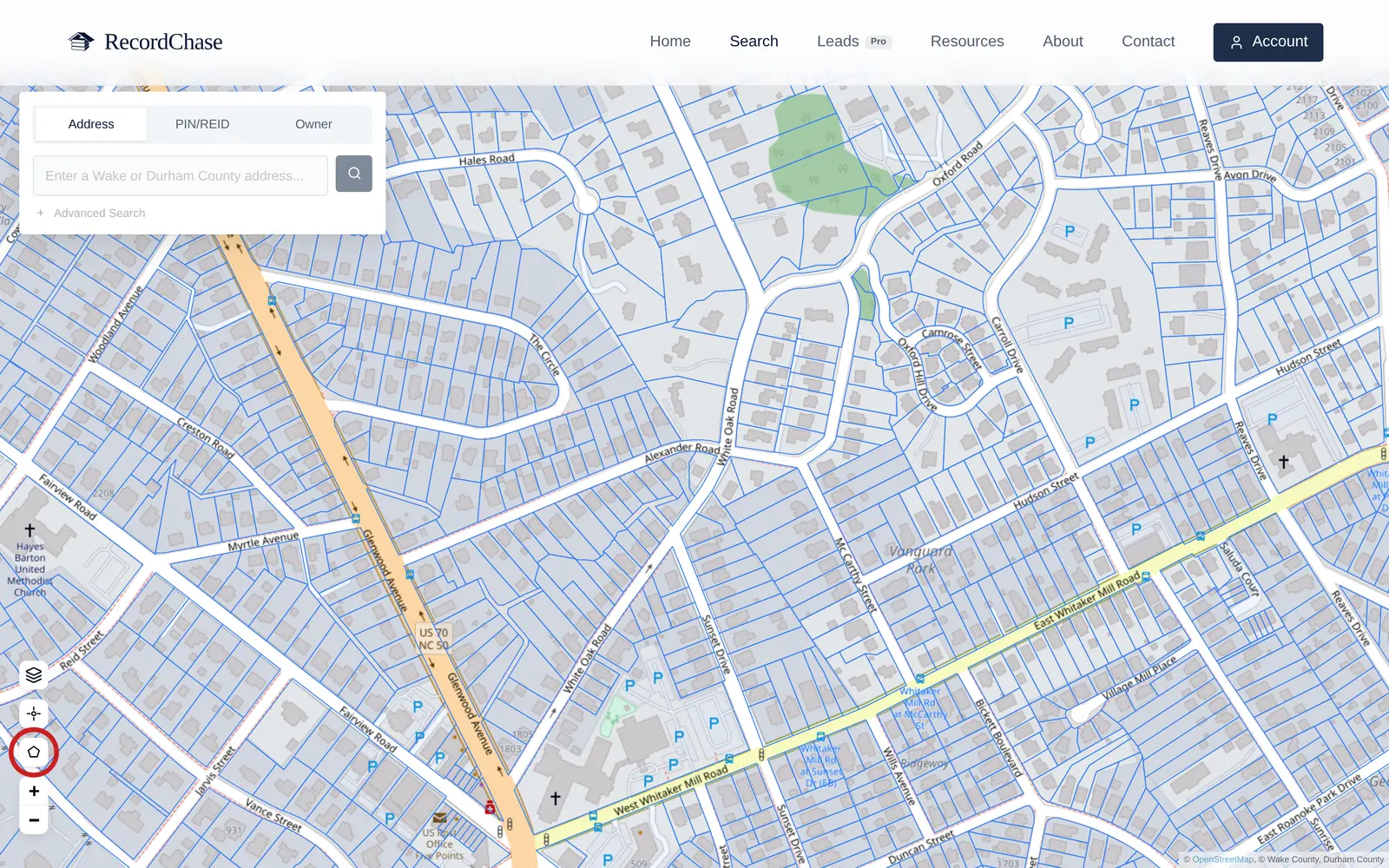
- Click the polygon icon in the map controls ("Draw area to search"). The cursor becomes a crosshair.
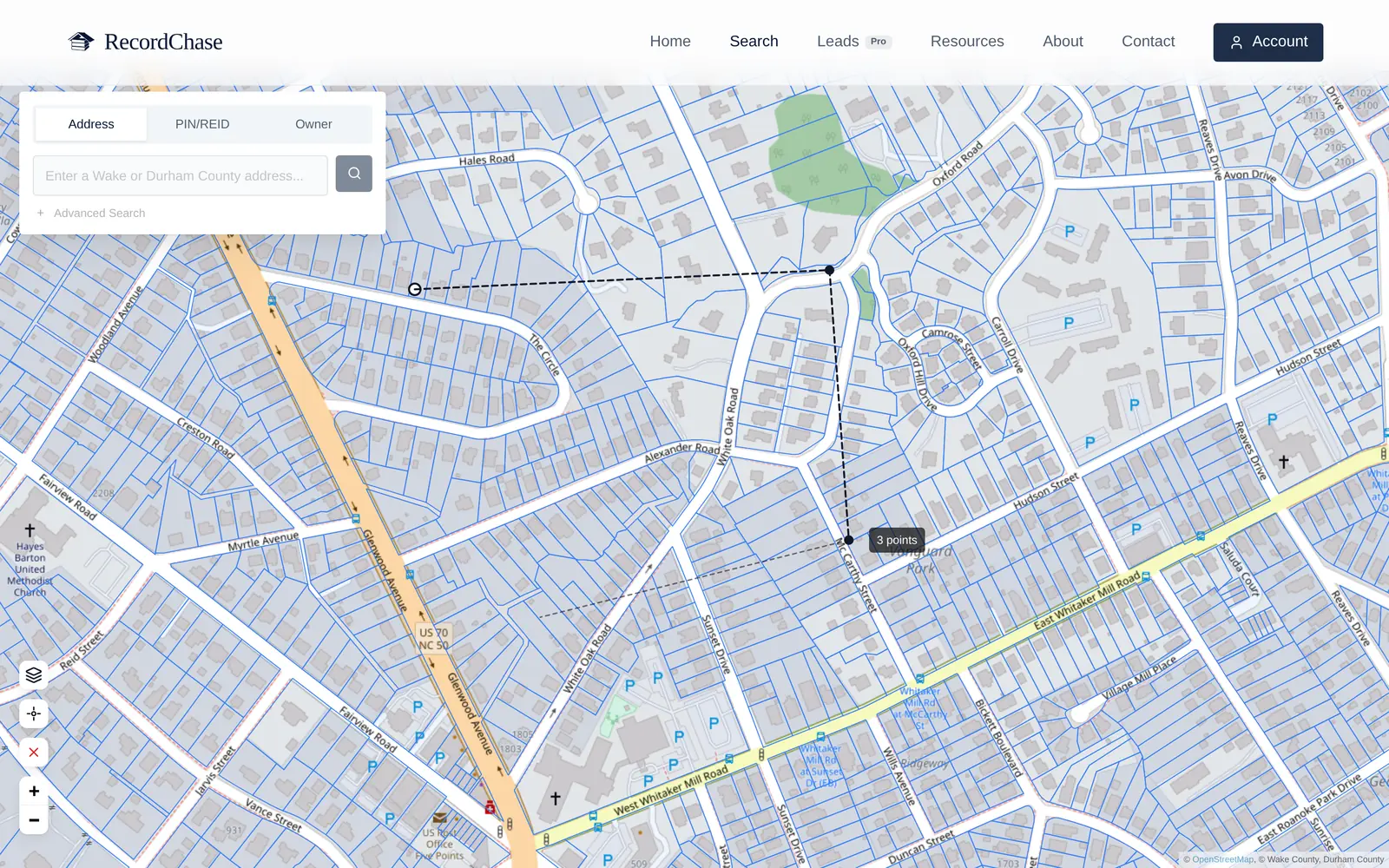
- Click to drop points around your area. A dashed line follows your cursor from the last point so you can see each edge before you commit it.
- Close the shape by clicking back on your first point, or just double-click to finish. Three points minimum; a triangle is a perfectly good search area.
- Changed your mind mid-draw? Esc cancels.
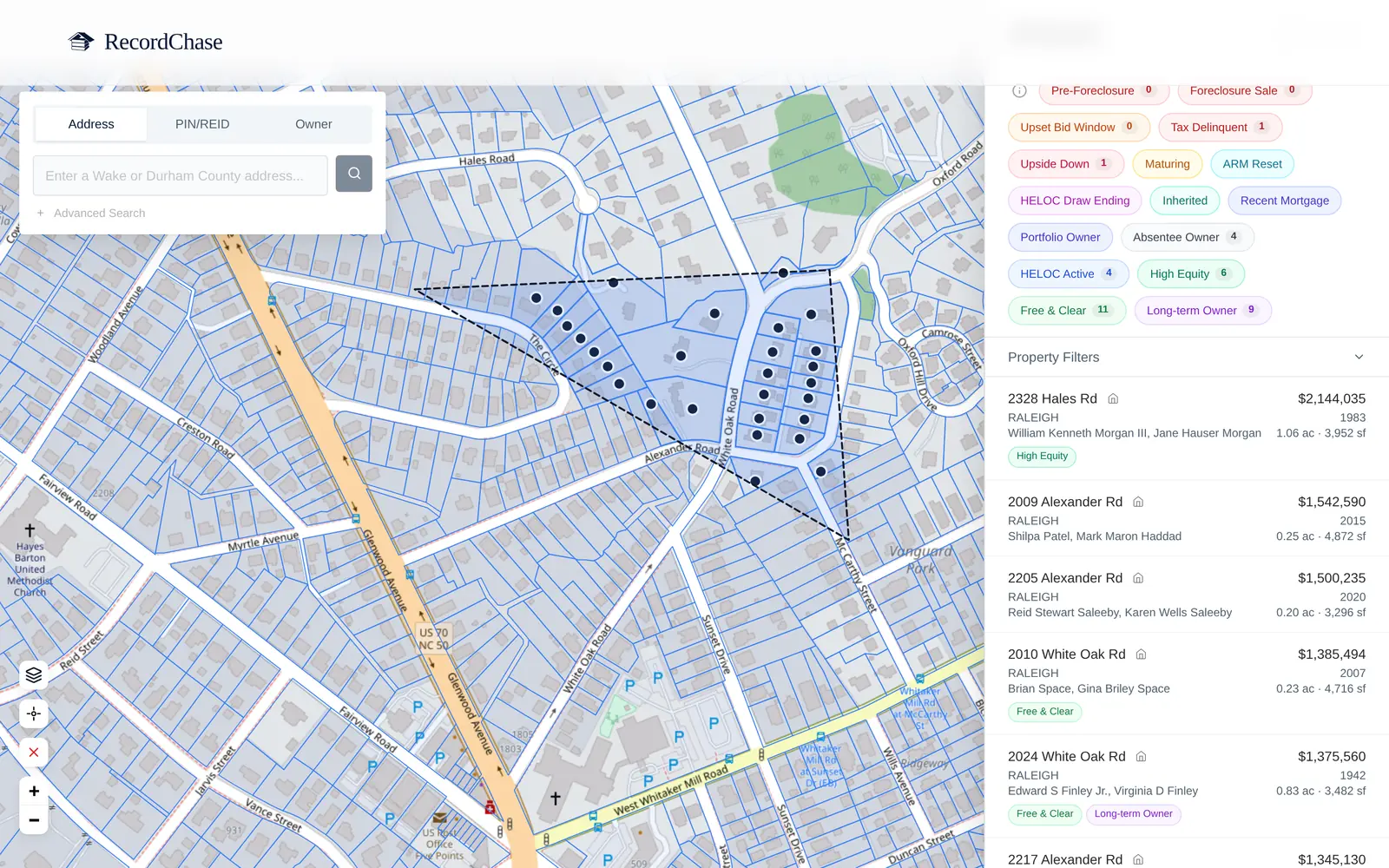
The finished polygon shades the search area, and the results panel lists every property inside it. From there you can click any parcel, on the map or in the list, to open its full record: ownership, document history, liens, and signals. Clicking outside the polygon (or using the control's clear button) resets the search.
Five area searches to try
A farm area. Draw the subdivision or blocks you regularly cover, then filter by ownership, tenure, loan age, or recent signals.
A comparable-sales pocket. Draw the streets that compete with the subject property rather than using an entire ZIP code, then review recent recorded transfers.
An area around new development. Draw the surrounding blocks, then identify absentee or long-tenure owners for further research.
A corridor. Follow a road project, transit route, zoning boundary, or other narrow area that a radius search would include poorly.
An HOA community. Isolate one community and check for assessment liens and HOA foreclosure filings without mixing in surrounding neighborhoods.
Tips
- Fewer points, honest edges. Six to ten well-placed points usually beat thirty fussy ones. You're defining a market boundary, not tracing parcel lines. Parcels are matched by their mapped property point, so leave a little margin around lots on the boundary.
- Draw at the zoom you mean. It's easier to be accurate about "this side of the tracks" when the tracks are on screen.
- Redraw freely. Clearing and redrawing is instant. Iterate the boundary until the result list matches the market you have in mind.
- Stack filters after. The area defines where; signal filters define who. The drawn-area results run through the same engine as the leads search, so you can combine a drawn farm with absentee, free-and-clear, or foreclosure-stage filters, plus value, square-footage, and acreage ranges, to turn geography into a contact list.
See it on the map
RecordChase brings Wake, Durham, and Orange property records, recorded documents, lien history, and foreclosure signals together in one searchable map.
Start Searching